Google Maps has recently received a significant update packed with AI-powered enhancements, making the app even more useful for both pedestrians and drivers. Here are the five best new features that you can look forward to using. My personal favorite seems to be the "Immersive View for Routes" feature. It will combine Street View, aerial imagery and live information such as weather and traffic in order to provide a top down photo-realistic view of your planned route. Have a look at my Top 5 AI-Powered Features that could potentially help you navigate even better.
1. Immersive View for Routes
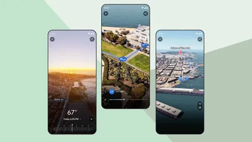
The standout feature is Immersive View for Routes. This combines Street View, aerial images, and real-time data like weather and traffic. It gives a top-down, realistic view of your planned route, making it easier to see your journey before you start. Whether you’re navigating New York’s streets or Venice’s canals, this feature shows your route with simulated weather and traffic conditions based on past data.
Recently, this feature is finally rolling out in the 15 cities Google mentioned back in May:
- Amsterdam,
- Barcelona,
- Dublin,
- Florence,
- Las Vegas,
- London,
- Los Angeles,
- Miami,
- New York,
- Paris,
- San Francisco,
- San Jose,
- Seattle,
- Tokyo
- and Venice.
2. Enhanced Search Functionality
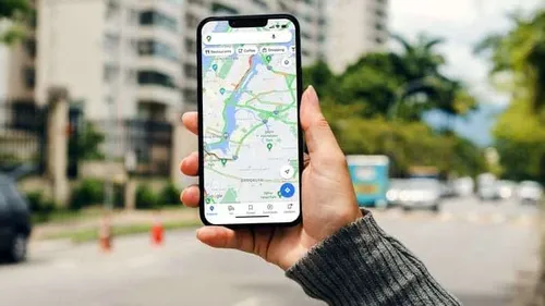
Google Maps’ search has improved with AI. The search now gives photo-first results from billions of user-shared photos. So, when you search for something specific, like “animal latte art,” you’ll see relevant and engaging photo results.
Example: Finding Local Attractions using AI
Mark, an art enthusiast, used the enhanced search to find “art exhibitions” nearby. The photo-first results helped him quickly find and visit several local galleries during his weekend trip. Instead of reading text-based reviews, he saw actual images of the exhibitions, making his decisions faster and more enjoyable.
3. AR-Powered ‘Lens in Maps’
Previously called ‘Search with Live View,’ this feature now uses Google Lens to label buildings and landmarks through your phone’s camera. This is useful when you’re in a new area and need to identify your surroundings quickly. By tapping the ‘Lens’ icon in the Google Maps search bar, you can open a live camera view and see labels for restaurants, ATMs, stations, and landmarks around you.
This feature is coming to dozens of new cities including Austin, Las Vegas, Rome, São Paulo, and Taipei.
Case Study: Exploring Rome
During her first visit to Rome, Sarah used ‘Lens in Maps’ to identify historical sites and nearby amenities like cafes and ATMs, enhancing her sightseeing experience. This feature made it easy for her to navigate the city without constantly checking a map, giving her more time to enjoy the sights.
4. Improved Driving Navigation
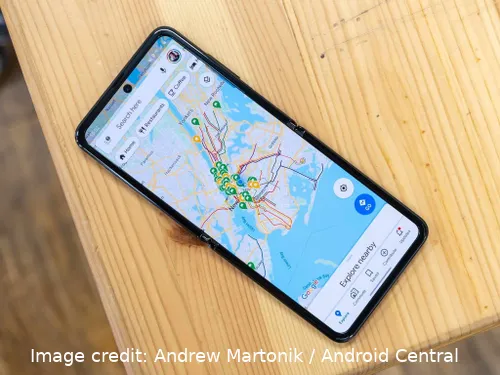
Image credit: Andrew Martonik / Android Central
For drivers, Google Maps has improved its navigation features. Updates include better lane details, more realistic building representations, and the addition of HOV (High-Occupancy Vehicle) lanes. These improvements help drivers navigate complex routes more accurately and safely. We expect to see these navigation improvements for drivers available in the "coming months" in 12 countries, including the US, Canada, France, and Germany. To be honest, we may have a timeframe of 3-6 months ahead of us, but it's something to look out for.
Example: Commuting in Los Angeles
John, who commutes daily in Los Angeles, found the improved lane details and realistic buildings extremely helpful in navigating complex freeway exits and city streets. These improvements reduced his commute time and stress, making his daily drive more manageable.
5. Enhanced EV Charger Information
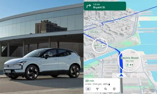
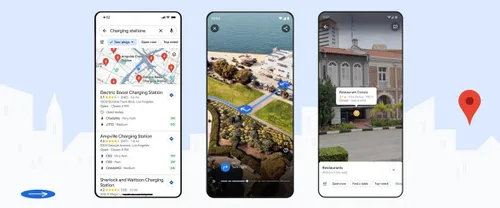
Google Maps has also improved its information for electric vehicle (EV) owners. The app now provides detailed data about charging stations, including compatibility with your car, charging speeds, and recent usage. Google confirms that 25% of EV chargers in the US are down at any given time, so this feature aims to reduce the hassle of finding functional chargers and helps EV owners plan their routes more efficiently.
Example: EV Charging in San Francisco
Emily, an EV owner, used Google Maps to find a fast charger compatible with her car. The updated information helped her avoid non-functional chargers, saving time and reducing range anxiety. Knowing when a charger was last used provided an additional layer of reliability in her planning.
Conclusion
Google Maps’ latest update introduces several AI-driven features that enhance the user experience for both walkers and drivers. From immersive route previews to improved search and AR capabilities, these updates make navigating and exploring easier and more intuitive. These enhancements show Google’s commitment to using AI to provide smarter, more helpful tools that cater to the diverse needs of its users.
Popular News
Latest News
Loading
